Farming technology has come a long way from the early days on farms throughout Kansas, but with modern day advances there is a new technology out there that can help a farmer is many different ways.
This new technology is unmanned aerial vehicles. These are radio and satellite controlled planes or drones that carry sophisticated equipment on board to monitor many different elements of a farmers fields, crops or even live stock.
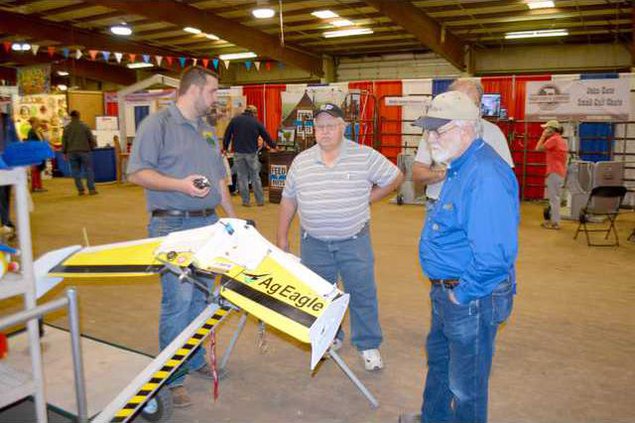
“This new technology has many benefits for farmers,” Owner of Precision Crop Imaging of Great Bend Sam Thier said. “Farmers can utilize this technology to monitor many different parts on their farms.”
This technology offers crop health monitoring, irrigation equipment monitoring, variable rate fertility and mid field weed identification.
“The biggest benefit with this technology it saves farmers money,” Thier said. “It really helps farmers utilize on spray inputs.”
The UAV aircraft takes infrared pictures of the field and sends that data back and puts an image together that the farmers can use to identify weak or dying crops, issues with their water system and many other related problems that farmers face on a daily basis.
According to precision drone. Using drones for crop surveillance can drastically increase farm crop yields while minimizing the cost of walking the fields or airplane fly-over filming.
The benefits of drones in farming include:
• Increase yields.
• Find potentially yield limiting problems in a timely fashion.
• Save time.
• Return on investment.
According to sense fly if precision technology has driven the farming revolution of recent years, monitoring crops from the sky will drive the next.
With a drone or UAV you can capture highly accurate images of fields, covering up to hundreds of hectares/acres in a single flight. Without the cost and hassle of manned services.
This technology offers greater resolution than satellite imagery provides, even when there is cloud cover.
By using image processing software the farmer can then transform these shots into one large ‘orthomosaic’ image.
This map is the key to boosting yields, cutting costs and driving the business forwards. It highlights exactly which areas of crop need closer examination – meaning less time spent scouting, and more time treating the plants that need it.
For more information contact Sam Thier at 620-617-1808 or email him at precisioncropimaging@gmail.com.
New technology helps farmers