
The Kansas Byways Program
Scenic roadways serve as natural, social, cultural and economic resources for the visitors to the state of Kansas, the people of Kansas and the local communities in which the roadways are located. The program is a cooperative effort among private citizens, local groups, local governments and state government agencies.
The Kansas Byways Program was formed to identify and designate scenic roadways for the enjoyment of the traveling public in Kansas.
The Kansas Byways Program is related to the National Scenic Byways Program, a project of the 1991 Intermodal Surface Transportation Efficiency Act. The National Scenic Byways Program seeks to identify and designate national scenic byways to increase tourism and educate the traveling public about our nation’s environment, history and culture.
Kansas has 11 recognized byways. They include:
• Flint Hills
• Frontier Military
• Glacial Hills
• Gypsum Hills
• Native Stone
• Post Rock
• Prairie Trail
• Route 66
• Smoky Valley
• Western Vistas
• Wetlands & Wildlife
Of these, only two have national status – the Flint Hills and the Wetlands and Wildlife.
More information on each is available at travelks.com/ksbyways.
Travelers who linger longer spend more and take more time enjoying the scenery. And the slower the travel, the longer those travelers hang around.
Sadly, Omaha, Neb.-based consultant Martin Shukert told Wetlands and Wildlife Scenic Byway enthusiasts Wednesday afternoon, Kansas’ byway system was created around speedier vehicles. He wants to help change that and make these destinations more accessible to bicycle and foot traffic.
“We want to open them up to more than cars,” Shukert said.
Shukert’s RDG Planning and Design is under contract with the Kansas Department of Wildlife, Parks and Tourism and the Kansas Department of Transportation to develop a bicycle/pedestrian master plan for the state’s 11 byways. This includes the 70-plus mile Wetlands and Wildlife National Scenic Byway stretching from Cheyenne Bottoms in Barton County to Quivira National Wildlife Refuge in Stafford County.
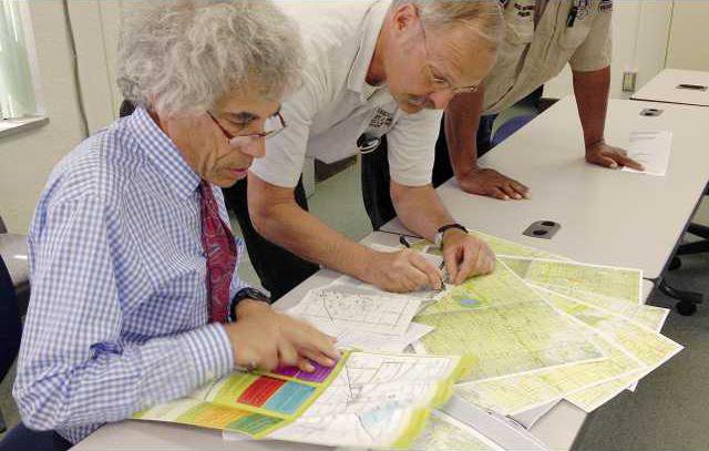
Shukert and fellow RDG representative Joe Kotulak led a meeting Wednesday at the Barton County Courthouse. Their goal was to gather input for the plan from the local byway, economic development and county administrators officials, as well as the general public.
They held a similar meeting Thursday afternoon in Hudson, near the southern wildlife byway terminus.
“No one has taken this kind of approach before,” Shukert said. As far as he knows, Kansas is the only state to start looking at byways so comprehensively.
Some have looked at so-called active transportation, but not viewed it strategically as a way to bolster tourism and economic development.
A plan in the making
Shukert and Kotulak are in Kansas visiting each of the byways and talking with local residents. Shukert also takes time to bike stretches of each, to a get a feel for them.
“June through August is our time to ride,” he said. “We can get details on each of these byways. We can experience the byways the way we want others to experience them.”
It is all part of their research. They are gathering information on features, attractions and topography, and taking photos to incorporate in their report.
So far, they have been to the Flint Hills National Scenic Byway and the Native Stone Scenic Byway, both in eastern Kansas.
Unfortunately, since most follow federal, state of local blacktop roads, they were designed with motor vehicles in mind.
But, “when people spend more time in a region, they spend more money,” he said. Obviously, someone on a bike or foot will take longer to tour a byway than if they whiz through it at 65 miles per hour.
“If you are biking, you are more likely to stay over night, and eat, drink and stay in the area,” he said. “Economically, the returns get to be a lot greater.”
There is also a less tangible benefit. “At a slower pace, you can communicate the essence of a place, the feel of it.”
Although this can’t be quantified, he said it is equally important. “We want to create an experience and package the byway and the area to showcase it.”
So, to this end, RDG is interested in what “policies, projects and plans” it can include in its plan, Shukert said. The idea is to make the byways interesting enough to lure people off the Interstate and “make it compelling as a destination trip for bicyclists and pedestrians.”
Seeking guidance
Shukert tossed out such suggestions as multi-use trails, safety shelters, signs, expanded road shoulders, painted bike lanes, road markings and bike repair stations. “We want to promote bicycle and pedestrian friendliness. We want to adapt this byway to active transposition.”
He then asked for ideas.
“Our corridor is not just the byway,” said Cris Collier, Great Bend Convention and Visitors Bureau executive director and stanch byway promoter. “It is six miles wide and takes in all the communities.”
This is important to note, she said. “That authentic, small town feel has an appeal. Each has its own signature.”
These communities include Claflin, Ellinwood, Great Bend, Hoisington, Hudson, Stafford and St. John.
Also, despite including two wetlands of international importance, the wetlands byway often gets overshadowed by the more well-known Flint Hills National Scenic Byway. Collier wanted to make sure both were treated equally.
Of the 11 byways in the state, only the Flint Hills and Wetlands and Wildlife have national status.
The local byway has a lot to offer, from the wetlands themselves to the towns to the natural beauty in between, Collier said. The GBCVB has developed maps showing bike paths, audio tour guides and an interactive web-based map with area attractions.
“Kansas is our strongest market for visitors,” Collier said. But, there is also traffic from other states, predominately the upper Midwest and the Southeast.
Whatever else is included in the plan, “the key is to improve connectivity,” said Curtis Wolf, director of the Kansas Wetlands Education Center located near Cheyenne Bottoms.
He referred to improvements in roads that would connect the wetlands and the cities along the route, as well as well-connected interior routes within the towns.
This led to another important factor – safety. Shukert said it also important for riders and hikers to feel comfortable and secure, and this is where signs and other markings come into play.
The fact that most of the route follows low-traffic county blacktops or highways with wide shoulders are good things, he said. “In terms of creature comforts, this byway is the best.”
Keeping it prospective
Improvements should include the needs of those of all skill levels, and both road and off-road cyclists, Shukert said.
But, the improvements should not mar the landscape, Collier said. “We believe in promoting the byway, but not at the expense of the resource.”
Shukert will take the ideas generated at the meetings into consideration when he makes a proposal to state officials. A rough draft of the plan will be available for the Wetlands and Wildlife National Scenic Byway Committee to review before it is presented.
A date for the draft to be completed has not been set.


