Last year, staff from JEO Consulting Group drove every block of Great Bend streets to complete the Pavement Management Plan (PMP) approved by the City Council on March 2. In a presentation to the council in February, Brad Shores and Jason Peek from JEO said that on a scale of 0 to 100, where 100 is the best, Great Bend’s streets rated a respectable 77.7.
By comparison, Lawrence streets rated 63.1 in a 2023 study and Topeka’s rated 64 in 2022. Dodge City rated 69.9 in 2017. Augusta was slightly better than Great Bend, scoring 80 in 2025.
The study also included Tiger Eye video collection using two GoPro cameras.
JEO submitted a PMP with a 10-year Capital Improvement Program (CIP) in three phases: three years, three years and four years. The top priorities are in Phase One, and the choices were “data-driven,” Shores said.
He said the city has 123 center-line miles of streets and 121 miles of paved public streets. That’s an estimated value of $374 million in pavement, making the system one of the community’s most valuable public assets. The overall rating of 77.7 is considered “good.” (Above 85 is “very good.”)
“Augusta has 40% of the center-line miles you have,” Shores noted, adding the condition of Great Bend’s streets is “something to be proud of.”
Some money to pay for street maintenance comes from grants, but the bulk of funding comes from a quarter-cent sales tax earmarked specifically for that purpose. The sales tax was renewed in 2018 and raises, on average, $1.3 million a year.
It was noted that the sales tax is scheduled to sunset in 2028 unless it can be extended. “The sales tax is very important,” Shores said.
“We believe you’ve been spending $1.5-2 million a year on streets over the past five years,” he said. “The plan I’m showing you, has you spending even more. $2.7 million per year would keep things about as good as they are today.”
Most communities put off pavement maintenance he said. Shores compared that to driving a car until it breaks down and never taking time to change the oil. “A light touch earlier in the process is what you should be doing.”
Without a proactive and systematic maintenance program, pavement conditions can decline rapidly and become significantly more expensive to rehabilitate or reconstruct, the engineers noted. Rather than reacting to visible failures or relying solely on anecdotal concerns, the PMP uses condition data, lifecycle cost analysis and performance modeling to recommend the right treatment at the right time.
There are a lot of projects in the “lighter touches” category, he said. These may include crack sealing, microsurfacing and mill and overlay before streets deteriorate to the point of requiring full reconstruction.
The city already recognizes where the most obvious needs are.
“We did not know what projects you would do last year (as the study was going on). They were all in our Phase One plan,” Shores said.
JEO can help the city get more grants, and prioritize projects, he said. Their staff interact with other departments, so they won’t recommend paving a street that has upcoming utility work, for example.
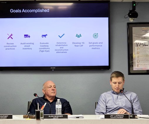
Councilmembers had questions during the work session. Kevyn Soupiset asked which is better – asphalt or concrete.
“You need the right mix,” Peek said, adding pavement life cycle varies. A residential street is designed to last 30 years with proper maintenance.
City Administrator Logan Burns noted that concrete is more expensive than asphalt. “We’re not going to be doing very many street projects if we’re going concrete,” he said.
Peek agreed there are “no simple answers” and “at the end of the day there’s only so much money to go around.” That’s why he urged the council to be committed to data-driven decision making.
Shores said 10 blocks are suggested for complete reconstruction. The next step after the presentation was for the council to approve the PMP, which it did on March 3. Public Works Director David Dunecack said he would like to sit down with the council sometime to talk about Phase One.
“I know Logan and I have already driven around and looked at these streets, and we have some of our priorities, but I also want you guy’s input as well,” Dunecack said. They could provide a list “or just come down and ride with me if you get time.”
“There’s a series of roads that we’re looking to do,” Burns said. “Obviously, we talked about trying to increase that budget to about $2 million this year, and then every year after that. That’s obviously going to depend on sales tax collection, but the biggest thing is just making sure we can fit everything into that budget. We’ll be bringing that back (for council approval) before we decide on that.”
The worst streets
Examples of “poor” and “very poor” streets in Great Bend were:
• Timber Creek Road - Where raveling and alligator cracking are causing the pavement surface to fall apart.
• 11th St. - Several patches are in poor condition, while the rest of the street is mostly fine. Targeted spot repairs might help extend its life, but it may be better to let this one wait and reconstruct it later. (Comments by JEO)
• Holland St. was rated “very poor” due to the significant alligator cracks, rutting, block cracks and paint failures over nearly the whole surface. One area showed minor potholes.
• Cherry Lane was rated “very poor” as nearly every panel is shattered into small pieces, the cracks are unsealed, and some areas are starting to settle.
Phase One recommended projects
The Pavement Management Plan approved by the Great Bend City Council lists these possible street projects for the next three years (Phase One of a 10-year plan). Some may already have been done.
• U.S. 281 (Main Street) from Broadway to 19th Street
• 24th Street from Monroe to Sunset Road
• Washington Street from Sunset Road to 19th Street; from Forest to Lakin and from Quivira to 31st and 510 feet north
• Broadway Ave. from Patton Road to K-96
• Harrison Street from 16th to 21st St.
• Patton Road from Eisenhower to 10th St. to 500 N., and from 16th St. Terrace to Rosewood Drive and Broadway to 16th St. Terrace
• 19th St. from Odell to Morton and from Washington to Odell
• 2nd St. from McKinley to 410 feet East and from Cleveland to 860 feet East.
• Frey St. from 11th to Park