Five days ago, a thunderstorm triggered hail in Barton County, that measured more than an inch in nearby Pawnee and Hodgeman counties.
Now, there’s record snow and a freeze warning for counties west and south of Great Bend.
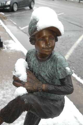
Friday morning, Barton County residents saw the first snow of the season that measured 4 inches at midway in Great Bend and five inches in Pawnee County. Barton County will typically receive six days of one-inch snow in a calendar year.
Wichita received snow in the air Friday, but it wasn’t measurable as of mid-afternoon. Wichita’s earliest recorded snowfall is Oct. 22. Surface temperatures ranged from 33 to 37 degrees in some areas, but colder air aloft made the precipitation snow rather than rain.
“It’s definitely an early snowfall,” said Scott Smith, Wichita meteorologist. “We had some cold air moving in and the snow was coming down at a high rate and made it to the ground. The freezing level was low in the atmosphere.”
Three inches of snow was reported eight miles southeast of Ness City. Two inches were reported in Dodge City. More than an inch was reported in Saline and Lincoln counties.
A 50-mile wide band of moderate snow from near Meade to Dodge City and Rush Center moved eastward at 30 mph.
Visibility was reduced to 1/4 to 1/2 mile within this snowband with additional 1/2-inch snow accumulations possible through early Friday afternoon. The snowfall will continue to make roads slick as it melts into slush.
The National Weather Service in Dodge City issued a hard freeze warning in effect from midnight Friday to 9 a.m. Saturday.
Temperatures are forecast to fall to between 25 and 28 degrees early Saturday morning.
Temperatures this cold can kill certain crops, damage other plants and freeze exposed pipes. The active growing season will likely end across much of this region after Saturday morning.
Parts of Scott and Lane counties have already experienced a hard freeze.
The National Weather Service in Dodge City reports late September and October snow events are relatively rare across western Kansas.
The earliest snow on record for western Kansas occurred on Sept. 21, 1995, with 7 inches in Utica, 4 inches in Healy, and two inches in Dodge City.
A major blizzard that many people undoubtedly remember occurred on Oct. 25, 1997 across western Kansas. Twelve inches of snow was reported in Garden City and 15 to 20 inches across far western Kansas
A notable snow event occurred on Oct. 8, 1970 when 11 inches of snow were reported at Plains and Greensburg. The Oct. 8, 1970 snowstorm started in New Mexico and the Texas Panhandle moved across parts of central and western Kansas on Oct. 8.
Early snowstorm fairly unusual


