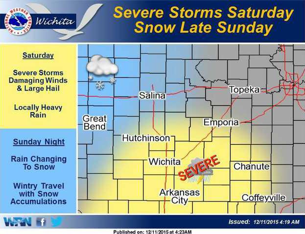

WICHITA — A variety of weather is expected this weekend with severe storms possible across south central and southeast Kansas Saturday afternoon and evening, according to the National Weather Service.
As colder air moves into the area on Sunday evening and Sunday night, light rain will transition to snow across portions of central Kansas, where some accumulations are possible.
Further west, Stafford, Rush and Pawnee counties are part of a widespread list of counties that are part of a weather advisory.
Snow is likely to develop late Saturday night and continue into Sunday. At this time, the most likely location for accumualting snow creating the greatest travel hazards is west of the highway 283 corridor toward the Colorado line.
A relatively warm atmosphere will to lead to a heavy wet snow, making roads very slick. a high degree of uncertainty exists with locations and snow amounts this storm system.
However several inches will be capable of having a significant impact on travel conditions overnight Saturday and during the day Sunday.
Other counties included in the weather advisory are Trego, Ellis, Scott, Lane, Ness, Hamilton, Kearny, Finney, Hodgeman, Stanton, Grant, Haskell, Gray, Ford, Edwards, Kiowa, Pratt, Morton, Stevens, Seward, Meade, Clark, Comanche and Barber counties.
Winter weather possible after stormy start Saturday

