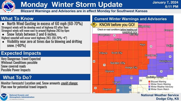
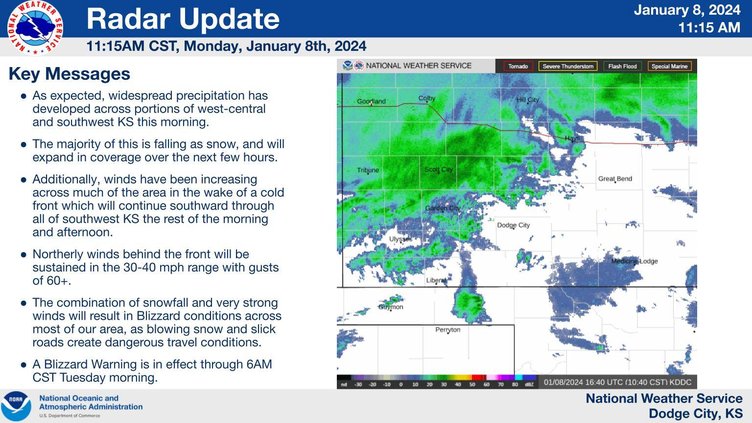
Blizzard conditions are expected to spread across much of southwest KS through the rest of the daytime hours and into the overnight period.
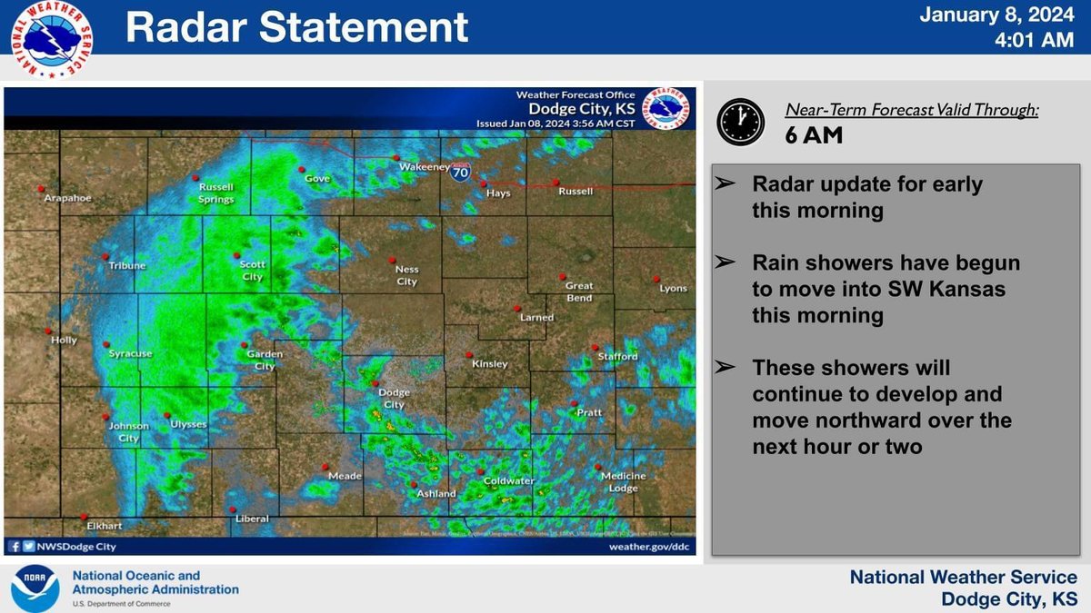
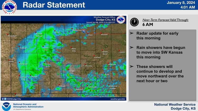
4:01 a.m.
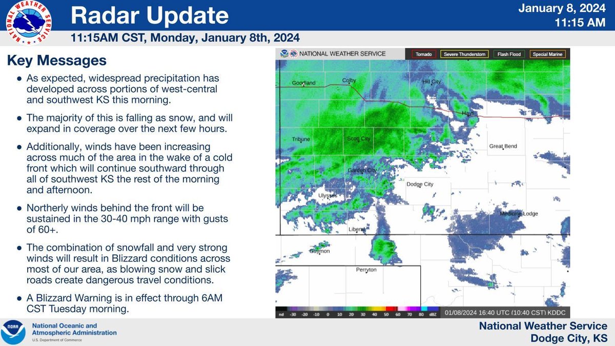
Rain showers have begun to move into SW Kansas this Monday morning. These showers will continue to develop and move northward over the next hour or two.
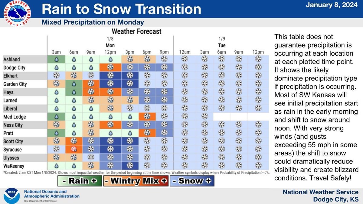
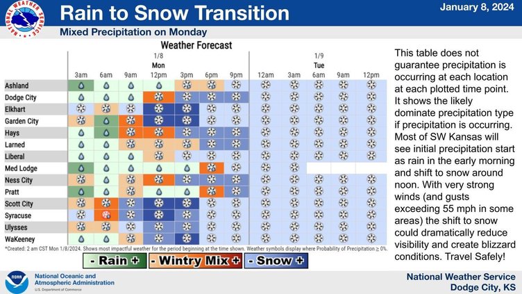
Most of SW Kansas will see a shift from rain to snow. With strong winds (and gusts exceeding 55 mph likely) the snow shift could reduce visibility and create blizzard conditions. See the active Blizzard warning for more information.

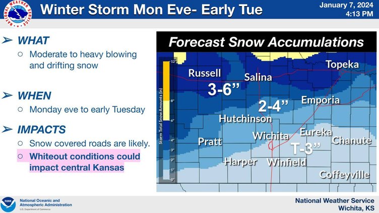
The Golden Belt is under Winter Storm and Blizzard warnings for Monday and Tuesday. Please be careful. We will work to keep you updated as conditions progress.
updates from the National Weather Service:
Widespread accumulating snow and wind gusts in excess of 60 mph will produce blizzard or near blizzard conditions across southwest Kansas Monday and early Monday night. Blizzard Warnings are in effect Monday and Monday night. Very dangerous travel conditions can be expected due to potential for near white out conditions. Stay up to date with the latest weather forecast and road conditions. Be prepared to adjust your travel plans as needed due to the weather and/or poor road conditions.
WINTER STORM WATCH NOW IN EFFECT FROM MONDAY MORNING THROUGH TUESDAY MORNING...
* WHAT...Heavy snow possible with wind gusts as high as 50 mph.
This could create near whiteout conditions.
* WHERE...Central Kansas.
* WHEN...From Monday morning through Tuesday morning.
* IMPACTS...Plan on slippery road conditions. Blowing snow could significantly reduce visibility. The hazardous conditions could impact the morning or evening commute and make travel very difficult to impossible.
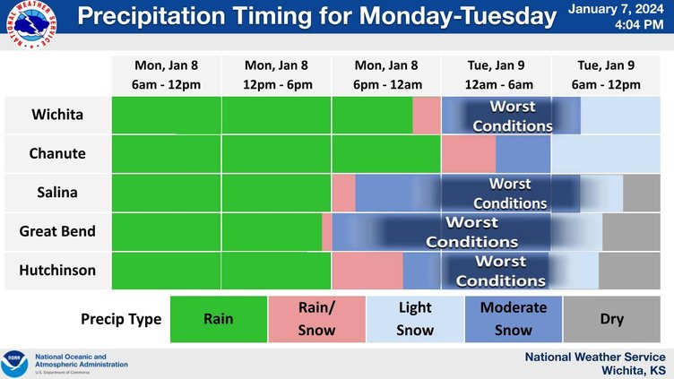
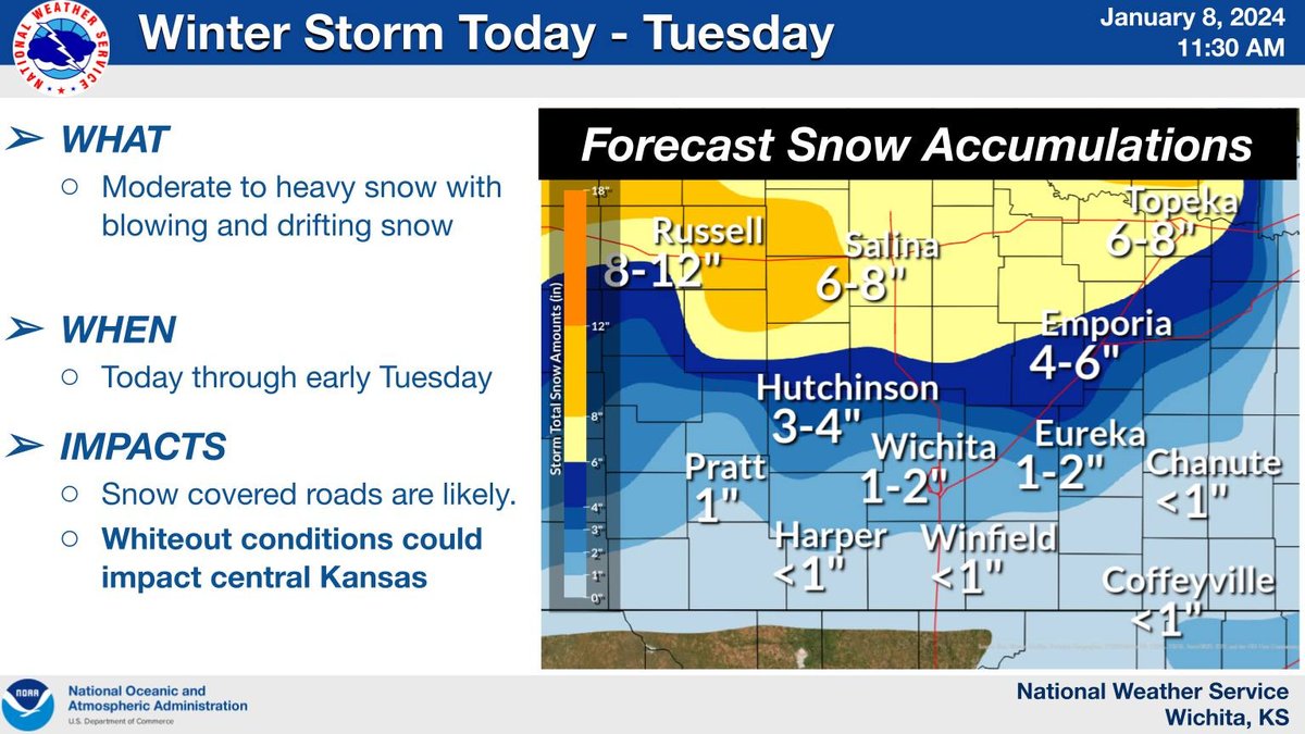
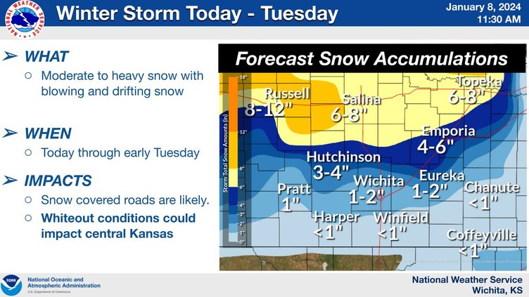
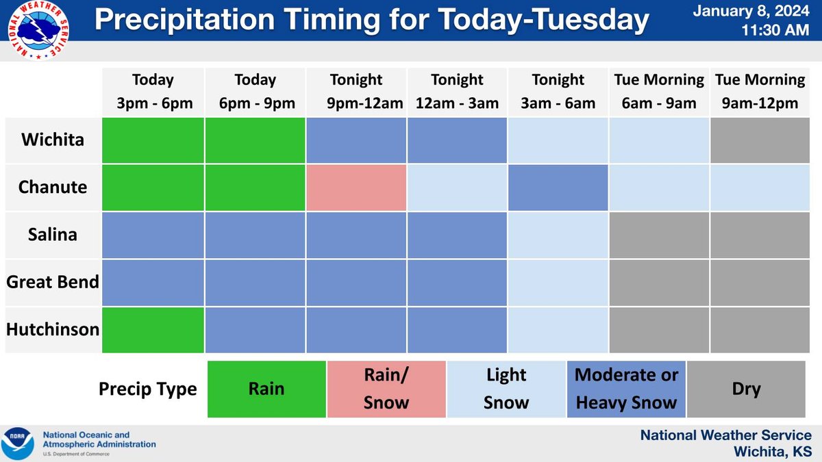
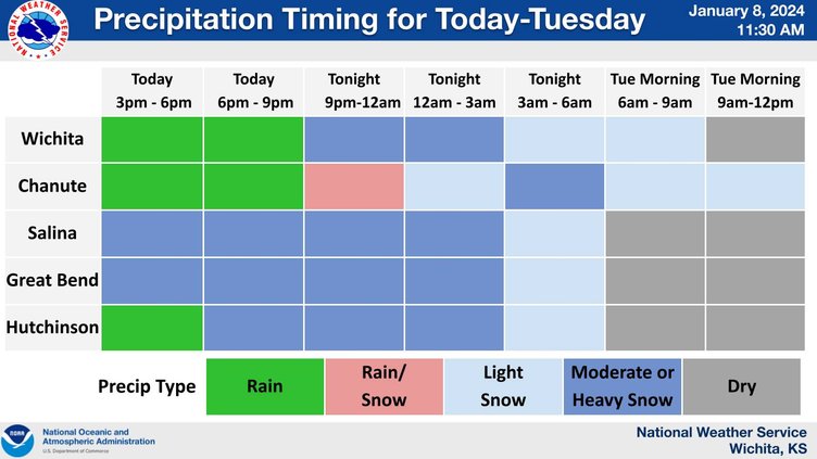
The next winter storm system will start impacting the area Monday and continue into Tuesday bringing another round of accumulating snow to the region. Very strong north winds could create significant blowing and drifting of snow.